Mapping Cameras with OpenStreetMap's Web UI
From Mass Pirate Wiki
This is a quick tutorial on how to map surveillance cameras with Open Street Map's web interface.
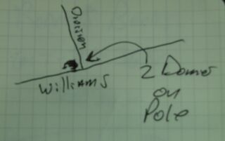
First, you'll need to find some surveillance cameras. I usually sketch them out in a small notebook. This is a sketch of two dome cameras on a telephone pole, at the corner of Division St. and Williams St. in Chelsea MA. Crude sketches are fine, as long as you can understand them later.
